What is the Paulins Kill Watershed Project Area?
The Upper Paulins Kill Watershed is one of the five major subwatershed basins of the Upper Delaware Watershed. Located within Sussex and Warren Counties in northwestern New Jersey, the Paulins Kill Watershed is about 197 square miles. This watershed area is mainly comprised of forested woodlands, wetlands, and agricultural lands, with only scattered light residential and commercial development and two small lake communities. The only exception is the Town of Newton, which is considered an urban center.
Why Develop a Watershed Restoration Plan for the Upper Paulins Kill Watershed?
The project area of the Upper Paulins Kill Watershed Restoration Plan has been a hot spot for residential growth and planning activity for many years. Significant portions of the stream have been identified as Category One waterways, and the project area also contains habitats for several threatened and endangered species, including the dwarf wedge mussel. However, the main driver for developing a watershed restoration plan for the Upper Paulins Kill is that the stream has been identified by the NJDEP as impaired for fecal coliform/E. coli, total phosphorus, dissolved oxygen, aquatic life, and arsenic at specific locations.
Paulins Kill Stream Corridor and Floodplain Restoration Initiative
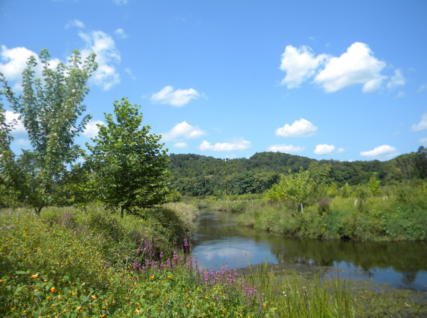
The WRWMG and its many conservation partners have been working together since 2012 to establish a four-mile continuous reforestation project along the Paulins Kill. Adjoining commercial, private agricultural, and state-owned public lands have been planted with the help of hundreds of local volunteers in an effort to shade the Paulins Kill, stabilize the erosive streambanks, prevent pollutant runoff from entering the river, and ultimately improve the long-term water quality of this important tributary to the Delaware River.
Town of Newton Community Watershed Restoration Initiative
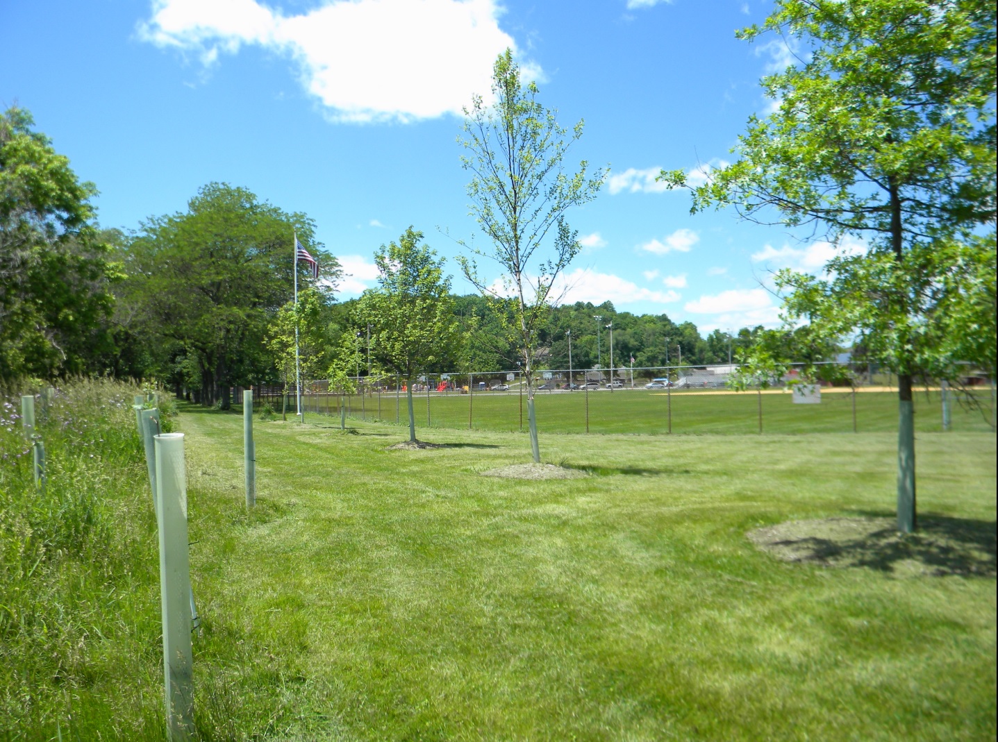
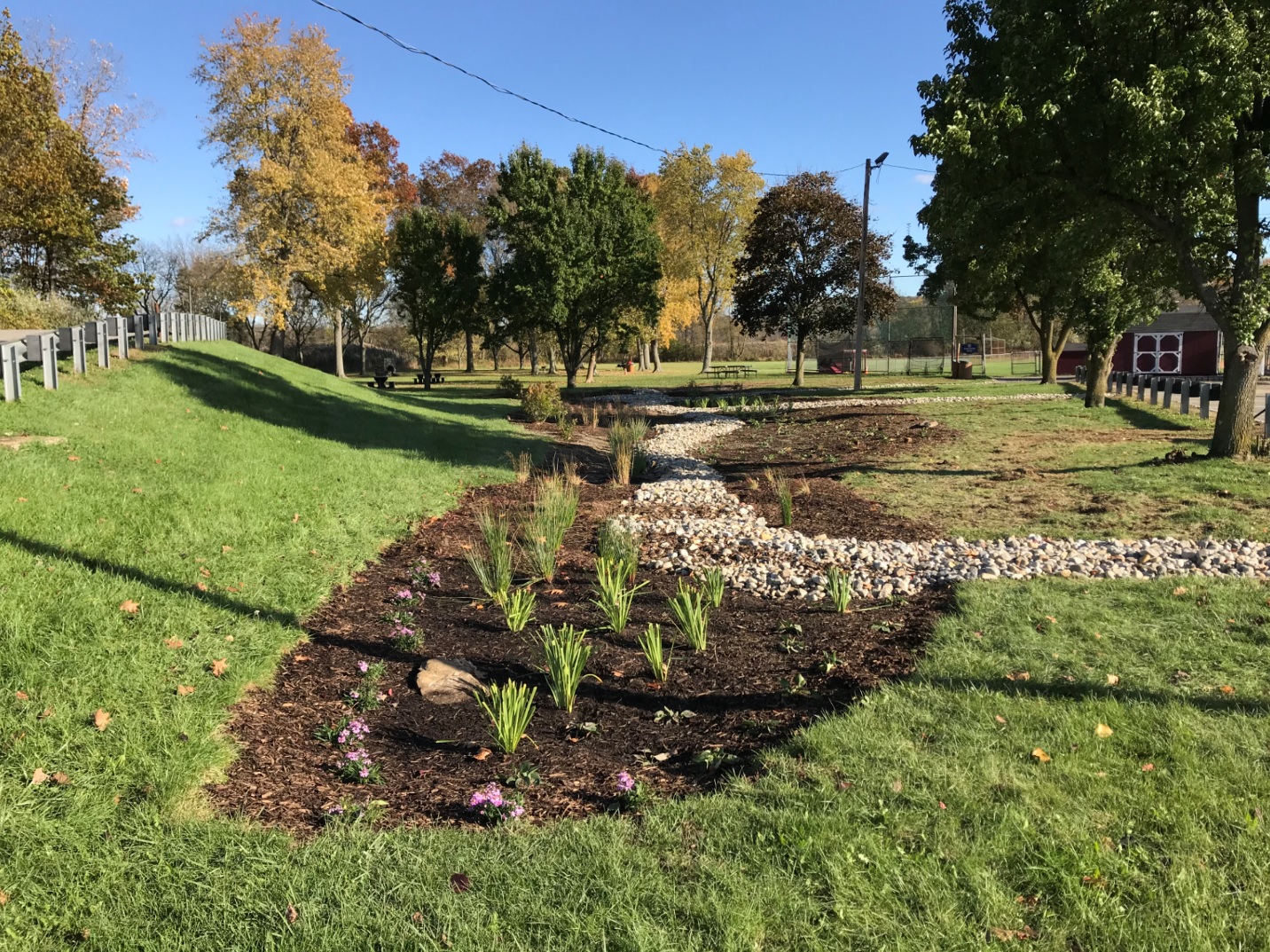
The WRWMG partnered with the Town of Newton to develop a Community Watershed Restoration Initiative to raise public awareness about watershed concerns while installing restoration projects to directly improve the headwaters of the Paulins Kill. As part of this Initiative, the WRWMG coordinated a stream debris clean-up with the Newton Department of Public Works, organized a litter clean-up with 350 students, staff, and parent volunteers from Halsted Middle School, and initiated a streamside reforestation project along the Paulins Kill at Memory Park. In October 2017, the WRWMG also installed a rain garden at Memory Park with assistance from Merriam Avenue School’s Earthkeepers club. Rain gardens are considered a best management practice for treating stormwater because they capture runoff from impervious surfaces, allowing water to seep into the ground rather than flowing directly into waterways via storm drains. Additionally, rain gardens are a valuable hands-on educational tool for informing community members about the importance of proper stormwater management.
In recent years, the WRWMG has also partnered with Sussex County Community College (SCCC) in Newton and organized the following educational opportunities for their environmental science students:
- an agricultural best management practice farm tour at a local beef operation
- a streamside reforestation planting day at the Sussex County Civil Defense Center
- Earth Week Celebration at SCCC, allowing the environmental science students to teach local 5th graders the environmental lessons SCCC students have learned in the classroom
- citizen science stream monitoring program in partnership with Stroud Water Research Center
Paulins Kill Lakes Initiative
Additionally, the SCMUA-Wallkill River Watershed Management Group has received funding from the William Penn Foundation to begin the Paulins Kill Lakes Initiative, a program aimed at installing a suite of green infrastructure projects in lake communities in the Paulins Kill Watershed. Green infrastructure is a process designed to decrease the amount of polluted stormwater runoff that enters waterways after a rainstorm by using natural features (like plants) to manage stormwater. Unlike traditional water management techniques that use pipes to remove water from neighborhoods as quickly as possible, green infrastructure projects mimic nature and allow collected stormwater to slowly soak into the ground and replenish groundwater sources that people rely on.
Through partnerships with lake associations and residents in the area, the SCMUA-Wallkill River Watershed Management Group hopes to create a movement that will encourage homeowners to install pollutant prevention projects on their own properties. Lakes participating in this initiative are: Culver Lake, Kemah Lake, Crandon Lakes, and Lake Owassa.